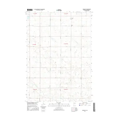
2016 Map of Wabasso SE
USGS Topo · Published 2016About this map
The Cottonwood River meanders across the southern landscape of this Redwood County region, joined by several tributaries including Pell Cr and Coal Mine Cr. This 2016 survey illustrates the structured agricultural grid of southwestern Minnesota, where a network of thoroughfares like Frontier Ave and Grandview Ave divide the prairie into neat sections. This landscape maintains deep local ties through its burial sites, specifically the Saint Matthews Cem and the smaller Schwahn Family Plot, which provide essential touchpoints for genealogical research. The northern portion of the map is defined by the winding course of Sleepy Eye Cr, which cuts through the fields before flowing eastward. The intersection of these watercourses and the rigid road system highlights the enduring rural character and spatial organization of the modern Minnesota farmstead.
Find a feature on this map
28 named features on this map. Tap any name to fly to it.
Don’t see what you’re looking for? This feature index may not catch every label — zoom into the map to look around manually.
Map Details
Editions of this 2016 Wabasso SE Map
This is the sole edition of this map. No revisions or reprints were ever made.
Other maps of this area

1953 · New Ulm
USGS Topo · 1:250,000

1957 · New Ulm
USGS Topo · 1:250,000

1958 · New Ulm
USGS Topo · 1:250,000

1967 · New Ulm
USGS Topo · 1:250,000

1967 · Wanda
USGS Topo · 1:24,000

1967 · Sanborn
USGS Topo · 1:24,000

1967 · Wabasso SE
USGS Topo · 1:24,000

1967 · Wabasso
USGS Topo · 1:24,000

1967 · Walnut Grove
USGS Topo · 1:24,000

1967 · Rowena
USGS Topo · 1:24,000