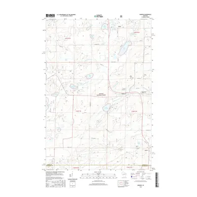
2015 Map of Wabeno
USGS Topo · Published 2015About this map
Wabeno and the adjacent settlement of Soperton serve as the primary hubs in this heavily forested landscape within the Nicolet National Forest. The local geography is defined by a dense network of glacial water bodies, including Trump Lake, Richardson Lake, and Bass Lake, which feed the various branches of the N Br Oconto River. The presence of numerous small cemeteries, such as Saint Ambrose Cem, Trinity Cem, and Forest Hill Cem near the town sites, provides significant points of interest for genealogists tracing local families in Forest County. Further south, the community of Carter sits near the crossing of Torpee Cr, while the northern reaches include the small locality of Padus. This 2015 survey illustrates how the region's development remains closely tied to its timber resources and the protected lands of the national forest system.
Find a feature on this map
70 named features on this map. Tap any name to fly to it.
Don’t see what you’re looking for? This feature index may not catch every label — zoom into the map to look around manually.
Map Details
Editions of this 2015 Wabeno Map
This is the sole edition of this map. No revisions or reprints were ever made.
Other maps of this area

1939 · Crandon
USGS Topo · 1:48,000

1939 · Laona
USGS Topo · 1:48,000

1941 · Crandon
USGS Topo · 1:48,000

1942 · Wabeno
USGS Topo · 1:48,000

1942 · Pearson
USGS Topo · 1:48,000

1946 · Laona
USGS Topo · 1:48,000

1947 · Crandon
USGS Topo · 1:48,000

1950 · Wabeno
USGS Topo · 1:48,000

1950 · Lily
USGS Topo · 1:48,000

1951 · Wabeno
USGS Topo · 1:48,000