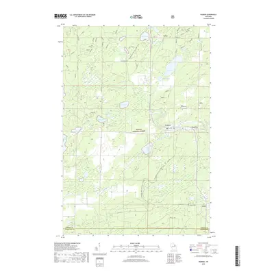
2018 Map of Wabeno
USGS Topo · Published 2018About this map
Wabeno and Soperton serve as the primary population centers in this northern forest landscape, situated along a central corridor within the Nicolet National Forest. The map documents a territory defined by its glacial hydrology, where numerous bodies of water like Trump Lake, Richardson Lake, and Eugene Lake are interconnected by systems such as the N Br Oconto River and Richardson Creek. This late-2010s survey captures the region's recreational and community infrastructure, showing the extensive Snowmobile Trail LKLN Forest and several local burial grounds, including Forest Hill Cem and Saint Ambrose Cem. The settlement at Carter and the junction at Padus further illustrate the distribution of small communities linked by rural routes like Elliot Road and Padus Rd, maintaining a historical settlement pattern in the Northwoods.
Find a feature on this map
45 named features on this map. Tap any name to fly to it.
Don’t see what you’re looking for? This feature index may not catch every label — zoom into the map to look around manually.
Map Details
Editions of this 2018 Wabeno Map
This is the sole edition of this map. No revisions or reprints were ever made.
Other maps of this area

1939 · Crandon
USGS Topo · 1:48,000

1939 · Laona
USGS Topo · 1:48,000

1941 · Crandon
USGS Topo · 1:48,000

1942 · Wabeno
USGS Topo · 1:48,000

1942 · Pearson
USGS Topo · 1:48,000

1946 · Laona
USGS Topo · 1:48,000

1947 · Crandon
USGS Topo · 1:48,000

1950 · Wabeno
USGS Topo · 1:48,000

1950 · Lily
USGS Topo · 1:48,000

1951 · Wabeno
USGS Topo · 1:48,000