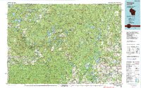
1990 Map of Wabeno
USGS Topo · Published 1991About this map
The Nicolet National Forest dominates this northern Wisconsin landscape, where timbered tracts and glacial waters define the local economy and culture. During the 1990s, the region supported a mix of forest management and recreational tourism centered around the Wolf River and the Peshtigo River. Small lumbering and railroad towns like Wabeno and Townsend are linked by the Chicago and North Western rail line, which served the area's industrial needs. To the south, the Menominee Indian Reservation and the Mole Lake settlement represent enduring tribal lands within the Northwoods. The map captures a sophisticated network of conservation areas, including the Wolf River State Fishery Area and the Lakewood State Fish Hatchery, alongside major hydro-electric and recreational water bodies such as Caldron Falls Reservoir and the Sandstone Flowage.
Find a feature on this map
44 named features on this map. Tap any name to fly to it.
Don’t see what you’re looking for? This feature index may not catch every label — zoom into the map to look around manually.
Map Details
Editions of this 1990 Wabeno Map
This is the sole edition of this map. No revisions or reprints were ever made.
Other maps of this area

1939 · Pembine
USGS Topo · 1:48,000

1939 · Porterfield
USGS Topo · 1:48,000

1939 · Dunbar
USGS Topo · 1:48,000

1939 · Crandon
USGS Topo · 1:48,000

1939 · Goodman
USGS Topo · 1:48,000

1939 · Laona
USGS Topo · 1:48,000

1940 · Thunder Mtn.
USGS Topo · 1:48,000

1940 · Monico
USGS Topo · 1:48,000

1940 · Athelstane
USGS Topo · 1:48,000

1941 · Crandon
USGS Topo · 1:48,000