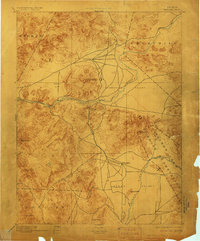
1894 Map of Wabuska
USGS Topo · Published 1906About this map
Walker Lake Indian Reservation dominates the southeastern quadrant of this late 19th-century reconnaissance, marking a significant tribal territory during the period of western expansion. The landscape is defined by the convergence of major waterways and early infrastructure, notably where the Colorado Railroad cuts across Mason Valley to reach the settlement at Wabuska. This junction highlights the area's role as a transit hub between the Carson River to the north and the Walker River to the south.
Find a feature on this map
29 named features on this map. Tap any name to fly to it.
Don’t see what you’re looking for? This feature index may not catch every label — zoom into the map to look around manually.
Map Details
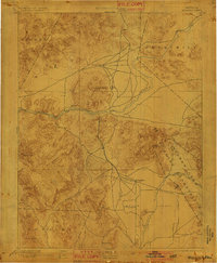
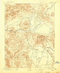
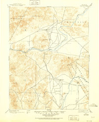
Editions of this 1894 Wabuska Map
6 editions found


Other maps of this area

1889 · Markleeville
USGS Topo · 1:125,000

1890 · Wadsworth
USGS Topo · 1:125,000

1891 · Carson
USGS Topo · 1:125,000

1891 · Markleeville
USGS Topo · 1:125,000

1891 · Wabuska
USGS Topo · 1:125,000

1891 · Reno
USGS Topo · 1:125,000

1891 · Wellington
USGS Topo · 1:125,000

1892 · Wadsworth
USGS Topo · 1:125,000

1893 · Carson
USGS Topo · 1:125,000

1893 · Markleeville
USGS Topo · 1:125,000