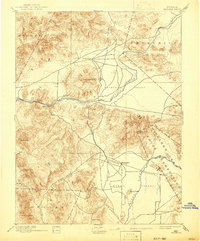
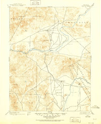
1894 Map of Wabuska
USGS Topo · Published 1942About this map
Mason Valley and the Churchill Valley define the drainage patterns of this high-desert landscape, where the Carson River and Walker River provided essential corridors for nineteenth-century movement. The survey, conducted by A.F. Dunnington and others in the late 1880s, captures a transition point between natural river courses and early infrastructure development. Small outposts and stage stops like Stockton Well, Howard, and Clifton are mapped alongside the fledgling path of the Colorado Railroad, which connects the settlement of Wabuska to the broader region.
Find a feature on this map
31 named features on this map. Tap any name to fly to it.
Don’t see what you’re looking for? This feature index may not catch every label — zoom into the map to look around manually.
Map Details
Editions of this 1894 Wabuska Map
6 editions found

Other maps of this area

1889 · Markleeville
USGS Topo · 1:125,000

1890 · Wadsworth
USGS Topo · 1:125,000

1891 · Carson
USGS Topo · 1:125,000

1891 · Markleeville
USGS Topo · 1:125,000

1891 · Wabuska
USGS Topo · 1:125,000

1891 · Reno
USGS Topo · 1:125,000

1891 · Wellington
USGS Topo · 1:125,000

1892 · Wadsworth
USGS Topo · 1:125,000

1893 · Carson
USGS Topo · 1:125,000

1893 · Markleeville
USGS Topo · 1:125,000