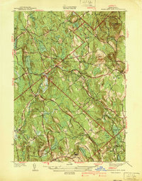
1940 Map of Wachusett Mtn
USGS Topo · Published 1940About this map
Wachusett Mountain dominates the northeast corner of this 1938 survey, anchoring the Wachusett Mountain State Reservation in a landscape defined by elevated hills and scattered water bodies. The terrain transitions from the heights of Little Wachusett and Calamint Hill toward the lower valleys of the East Branch Ware River. The area’s institutional history is prominent, featuring both the State Sanatorium and the Central New England Sanatorium near Rutland.
Find a feature on this map
48 named features on this map. Tap any name to fly to it.
Don’t see what you’re looking for? This feature index may not catch every label — zoom into the map to look around manually.
Map Details
Editions of this 1940 Wachusett Mtn Map
2 editions found
Other maps of this area

1885 · Worcester
USGS Topo · 1:62,500

1886 · Worcester
USGS Topo · 1:62,500

1887 · Winchendon
USGS Topo · 1:62,500

1887 · Barre
USGS Topo · 1:62,500

1887 · Fitchburg
USGS Topo · 1:62,500

1889 · Fitchburg
USGS Topo · 1:62,500

1889 · Barre
USGS Topo · 1:62,500

1890 · Winchendon
USGS Topo · 1:62,500

1892 · Worcester
USGS Topo · 1:62,500

1893 · Fitchburg
USGS Topo · 1:62,500