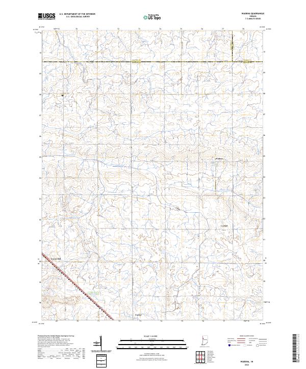
2022 Map of Wadena
USGS Topo · Published 2022About this map
Agricultural patterns and water management define the landscape of northern Benton County in this survey. The small settlements of Wadena and Lochiel serve as central points within an extensive grid of country roads, including E 900 N and W 400 N, which divide the terrain into traditional sections. Local history is anchored by the Dehner Cem in the northwest, while the southern edge of the map reaches into the outskirts of Fowler.
Find a feature on this map
38 named features on this map. Tap any name to fly to it.
Don’t see what you’re looking for? This feature index may not catch every label — zoom into the map to look around manually.
Map Details
Editions of this 2022 Wadena Map
This is the sole edition of this map. No revisions or reprints were ever made.
Other maps of this area

1953 · Danville
USGS Topo · 1:250,000

1955 · Danville
USGS Topo · 1:250,000

1956 · Danville
USGS Topo · 1:250,000

1961 · Kentland
USGS Topo · 1:24,000

1962 · Mount Gilboa
USGS Topo · 1:24,000

1962 · Wadena
USGS Topo · 1:24,000

1962 · Templeton
USGS Topo · 1:24,000

1962 · Boswell
USGS Topo · 1:24,000

1962 · Goodland
USGS Topo · 1:24,000

1962 · Earl Park
USGS Topo · 1:24,000