
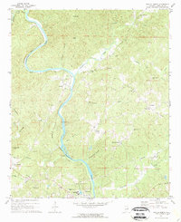
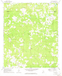
1969 Map of Wadley North
USGS Topo · Published 1973About this map
The Tallapoosa River carves a winding path through this corner of Randolph County, dictating the development of rural settlements and transport routes. Near the southern bend, Wadley serves as a local hub, anchored by the campus of Southern Union State College and the Seaboard Coast Line Railroad which follows the river's western bank. Further north, the settlement of Malone sits near significant Claypits, suggesting the importance of local mineral extraction in this era.
Find a feature on this map
52 named features on this map. Tap any name to fly to it.
Don’t see what you’re looking for? This feature index may not catch every label — zoom into the map to look around manually.
Map Details
Editions of this 1969 Wadley North Map
2 editions found
Other maps of this area

1891 · Ashland
USGS Topo · 1:125,000

1899 · Wedowee
USGS Topo · 1:125,000

1902 · Wedowee
USGS Topo · 1:125,000

1953 · Atlanta
USGS Topo · 1:250,000

1957 · Atlanta
USGS Topo · 1:250,000

1958 · Atlanta
USGS Topo · 1:250,000
1969 · Wedowee
USGS Topo · 1:24,000
1969 · Daviston
USGS Topo · 1:24,000
1969 · Wadley South
USGS Topo · 1:24,000
1969 · Milltown
USGS Topo · 1:24,000