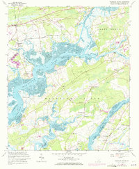
1960 Map of Wadmalaw Island
USGS Topo · Published 1972About this map
Wadmalaw Island and Johns Island are defined by a complex network of coastal waterways, where the Stono River meets the Wadmalaw Sound along the Intracoastal Waterway. This 1960 survey, updated in the early 1970s, reveals a landscape deeply connected to both the water and the rails. To the northwest, the Seaboard Coast Line Railroad serves the inland settlements of Hollywood and Meggett, while an Old Railroad Grade suggests an earlier era of transport reaching toward Yonges Island. Small communities and agricultural clusters are anchored by local institutions, including Wadmalaw School and a high concentration of country churches such as St James Bethel Church and Jerusalem Church. From the Landing Strip near the southern coast to the Church Flats in the north, the map documents a distinct South Carolina Lowcountry economy of riverside landings and rural crossroads like Smoak and Rivers.
Find a feature on this map
50 named features on this map. Tap any name to fly to it.
Don’t see what you’re looking for? This feature index may not catch every label — zoom into the map to look around manually.
Map Details
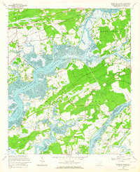
Editions of this 1960 Wadmalaw Island Map
2 editions found
Other maps of this area

1918 · Kiawah Island
USGS Topo · 1:21,120

1918 · Cottageville
USGS Topo · 1:62,500

1919 · Johns Island
USGS Topo · 1:21,120

1919 · Edisto Island
USGS Topo · 1:62,500

1919 · Wadmelaw Island
USGS Topo · 1:62,500

1919 · Legareville
USGS Topo · 1:21,120

1920 · Ravenels
USGS Topo · 1:62,500

1943 · Cottageville
USGS Topo · 1:62,500

1943 · Legareville
USGS Topo · 1:24,000

1943 · Edisto Island
USGS Topo · 1:62,500