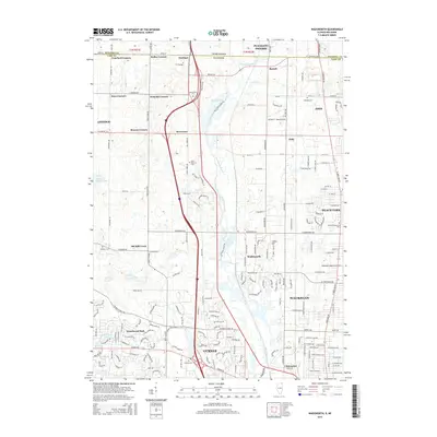
2015 Map of Wadsworth
USGS Topo · Published 2015About this map
The Des Plaines River corridor anchors this modern survey of northern Lake County, Illinois, where the suburban reaches of Waukegan and Gurnee meet a landscape of glacial lakes and historic road intersections. The map captures a transitional zone defined by large-scale transportation and utility, featuring the Waukegan Regional Airport and the smaller Herbert C. Maas Airport. For local historians and genealogists, the map preserves the names of long-standing family corners and community hubs, including Rosecrans, Slocum Corners, and Eddy. Conservation and recreation areas are evident through prominent water bodies such as Sterling Lake and Grandwood Lake, while the distribution of several cemeteries like Warren Cem and Saint Patricks Cem provides clear markers for tracing family heritage within the developing residential fabric of Beach Park and Wadsworth.
Find a feature on this map
80 named features on this map. Tap any name to fly to it.
Don’t see what you’re looking for? This feature index may not catch every label — zoom into the map to look around manually.
Map Details
Editions of this 2015 Wadsworth Map
This is the sole edition of this map. No revisions or reprints were ever made.
Other maps of this area

1892 · Racine
USGS Topo · 1:62,500

1893 · Silver Lake
USGS Topo · 1:62,500

1905 · Racine
USGS Topo · 1:62,500

1906 · Silver Lake
USGS Topo · 1:62,500

1906 · Waukegan
USGS Topo · 1:62,500

1908 · Waukegan
USGS Topo · 1:62,500

1920 · Grays Lake
USGS Topo · 1:62,500

1923 · Grays Lake
USGS Topo · 1:62,500

1954 · Rockford
USGS Topo · 1:250,000

1955 · Rockford
USGS Topo · 1:250,000