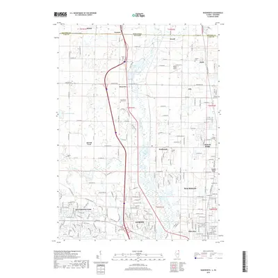
2018 Map of Wadsworth
USGS Topo · Published 2018About this map
The Des Plaines River corridor anchors this modern survey of the Illinois-Wisconsin borderlands, showing the dense network of roads and residential development that bridges the gap between suburban and rural Lake County. To the east, the urban expansion of Waukegan and Beach Park contrasts with the wetlands and conservation areas surrounding Sterling Lake. Genealogists will find several burial sites preserved across the landscape, including the Saint Patrick Catholic Cem near Rosecrans and the Benton Greenwood Cemetery in the eastern hills. The geography is shaped by aviation and transit, from the large footprints of the Waukegan Regional Airport and Herbert C Maas Airport to the Skokie Hwy and local thoroughfares like Wadsworth Rd, reflecting the area's continued growth as a northern Illinois residential hub.
Find a feature on this map
108 named features on this map. Tap any name to fly to it.
Don’t see what you’re looking for? This feature index may not catch every label — zoom into the map to look around manually.
Map Details
Editions of this 2018 Wadsworth Map
This is the sole edition of this map. No revisions or reprints were ever made.
Other maps of this area

1892 · Racine
USGS Topo · 1:62,500

1893 · Silver Lake
USGS Topo · 1:62,500

1905 · Racine
USGS Topo · 1:62,500

1906 · Silver Lake
USGS Topo · 1:62,500

1906 · Waukegan
USGS Topo · 1:62,500

1908 · Waukegan
USGS Topo · 1:62,500

1920 · Grays Lake
USGS Topo · 1:62,500

1923 · Grays Lake
USGS Topo · 1:62,500

1954 · Rockford
USGS Topo · 1:250,000

1955 · Rockford
USGS Topo · 1:250,000