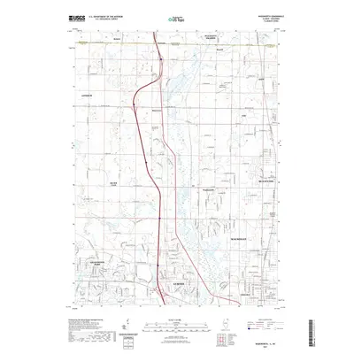
2021 Map of Wadsworth
USGS Topo · Published 2021About this map
The Des Plaines River corridor serves as the central spine of this landscape, winding southward between the expanding suburban clusters of Waukegan and Gurnee. This modern survey reveals a dense network of residential developments and aviation infrastructure, including the Waukegan National Airport and the smaller Herbert C Maas Airport to the north. While the southern portion of the quadrangle is heavily suburbanized, the northern reaches near Russell and Fossland along the Wisconsin-Illinois border maintain a more open character, preserved in part by the Forest Preserve lands. Genealogists and local historians will find a high concentration of burial grounds, such as Saint Patrick Catholic Cem and Oakdale Cem, which mark the original settlements of these northern Illinois townships before they were integrated into the broader Chicago metropolitan periphery.
Find a feature on this map
100 named features on this map. Tap any name to fly to it.
Don’t see what you’re looking for? This feature index may not catch every label — zoom into the map to look around manually.
Map Details
Editions of this 2021 Wadsworth Map
This is the sole edition of this map. No revisions or reprints were ever made.
Other maps of this area

1892 · Racine
USGS Topo · 1:62,500

1893 · Silver Lake
USGS Topo · 1:62,500

1905 · Racine
USGS Topo · 1:62,500

1906 · Silver Lake
USGS Topo · 1:62,500

1906 · Waukegan
USGS Topo · 1:62,500

1908 · Waukegan
USGS Topo · 1:62,500

1920 · Grays Lake
USGS Topo · 1:62,500

1923 · Grays Lake
USGS Topo · 1:62,500

1954 · Rockford
USGS Topo · 1:250,000

1955 · Rockford
USGS Topo · 1:250,000