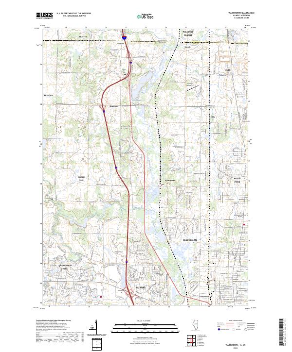
2024 Map of Wadsworth
USGS Topo · Published 2024About this map
The Des Plaines River winds through the heart of Lake County, defining the corridor between the northern border at Russell and the southern urban expansion of Gurnee. This contemporary survey illustrates the dense network of residential subdivisions and transportation arteries that have developed around established centers like Wadsworth and Old Mill Creek. The landscape is a mix of protected natural spaces, such as the Forest Preserve near Sterling Lake, and critical infrastructure including the Waukegan National Airport.
Find a feature on this map
76 named features on this map. Tap any name to fly to it.
Don’t see what you’re looking for? This feature index may not catch every label — zoom into the map to look around manually.
Map Details
Editions of this 2024 Wadsworth Map
This is the sole edition of this map. No revisions or reprints were ever made.
Other maps of this area

1892 · Racine
USGS Topo · 1:62,500

1893 · Silver Lake
USGS Topo · 1:62,500

1905 · Racine
USGS Topo · 1:62,500

1906 · Silver Lake
USGS Topo · 1:62,500

1906 · Waukegan
USGS Topo · 1:62,500

1908 · Waukegan
USGS Topo · 1:62,500

1920 · Grays Lake
USGS Topo · 1:62,500

1923 · Grays Lake
USGS Topo · 1:62,500

1954 · Rockford
USGS Topo · 1:250,000

1955 · Rockford
USGS Topo · 1:250,000