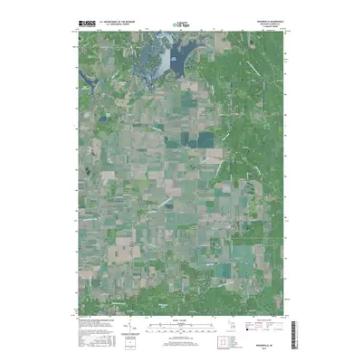
2017 Map of Wagarville
USGS Topo · Published 2017About this map
Wagarville and Mcclure anchor the southern portion of this mid-decade landscape, where the headwaters of the Little Tobacco River and several drainage systems like the Bennington Drain define the local topography. To the north, the terrain transitions into a more intricate network of water bodies and recreational residential developments. The area is characterized by substantial man-made water features, most notably Lake Lancer and Lake Lancelot, which are surrounded by a dense grid of winding roads such as Queens Way and Robinhood Way.
Find a feature on this map
91 named features on this map. Tap any name to fly to it.
Don’t see what you’re looking for? This feature index may not catch every label — zoom into the map to look around manually.
Map Details
Editions of this 2017 Wagarville Map
This is the sole edition of this map. No revisions or reprints were ever made.
Other maps of this area

1954 · Traverse City
USGS Topo · 1:250,000

1954 · Midland
USGS Topo · 1:250,000

1958 · Traverse City
USGS Topo · 1:250,000

1958 · Midland
USGS Topo · 1:250,000

1959 · Midland
USGS Topo · 1:250,000

1966 · Midland
USGS Topo · 1:250,000

1969 · Meredith
USGS Topo · 1:24,000

1969 · Edwards
USGS Topo · 1:24,000

1969 · Butman
USGS Topo · 1:24,000

1969 · Wagarville
USGS Topo · 1:24,000