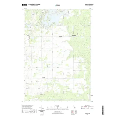
2019 Map of Wagarville
USGS Topo · Published 2019About this map
Lake Lancer and Lake Lancelot dominate the northern landscape of this Gladwin County survey, where residential development patterns wrap around the complex shorelines of these large water bodies. The terrain is defined by a dense network of drainage systems, including the Shell Drain, Weir Drain, and Ogg Drain, which manage the low-lying areas between the Sugar River and the Little Tobacco River. Smaller settlements like Wagarville, McClure, and Hockaday serve as local anchors in an area largely characterized by rural farmsteads and agricultural plots. Genealogists will find several burial sites noted, including Sacred Heart Cem, Ridge Cem, and McClure Cem, providing vital clues for family history research in Butman and Grout Townships. The map also captures the transition from lakeside communities to more traditional rural landscapes along routes like Wagarville Rd and Ritchie Rd.
Find a feature on this map
62 named features on this map. Tap any name to fly to it.
Don’t see what you’re looking for? This feature index may not catch every label — zoom into the map to look around manually.
Map Details
Editions of this 2019 Wagarville Map
This is the sole edition of this map. No revisions or reprints were ever made.
Other maps of this area

1954 · Traverse City
USGS Topo · 1:250,000

1954 · Midland
USGS Topo · 1:250,000

1958 · Traverse City
USGS Topo · 1:250,000

1958 · Midland
USGS Topo · 1:250,000

1959 · Midland
USGS Topo · 1:250,000

1966 · Midland
USGS Topo · 1:250,000

1969 · Meredith
USGS Topo · 1:24,000

1969 · Edwards
USGS Topo · 1:24,000

1969 · Butman
USGS Topo · 1:24,000

1969 · Wagarville
USGS Topo · 1:24,000