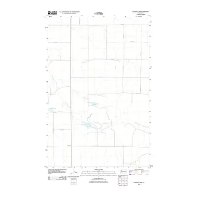
2011 Map of Wagner Lake
USGS Topo · Published 2011About this map
Sinking Creek winds through the heart of this Lincoln County landscape, defining a drainage pattern that feeds several small water bodies including Wagner Lake, O'Brien Lake, and the uniquely named H Lake. The map reveals a highly structured grid of section lines and rural roads, many bearing the names of local families who shaped the agricultural heritage of the region. Notable routes like Haden Farms Rd N, Smith Prather Rd, and Stambaugh Rd N serve as modern links to the homesteading era. Near the southern edge, the Wheat Ridge Cemetery stands as a significant site for genealogists and local historians, anchoring the community's history to the land. This 2011 survey by the U.S. Geological Survey captures the enduring agricultural character of the Washington wheat country, where the intersection of water resources and family-held acreage remains central to the landscape.
Find a feature on this map
22 named features on this map. Tap any name to fly to it.
Don’t see what you’re looking for? This feature index may not catch every label — zoom into the map to look around manually.
Map Details
Editions of this 2011 Wagner Lake Map
This is the sole edition of this map. No revisions or reprints were ever made.
Other maps of this area

1948 · Grand Coulee Dam
USGS Topo · 1:62,500

1948 · Wilbur
USGS Topo · 1:62,500

1950 · Wilbur
USGS Topo · 1:62,500

1950 · Grand Coulee Dam
USGS Topo · 1:62,500

1953 · Ritzville
USGS Topo · 1:250,000

1959 · Ritzville
USGS Topo · 1:250,000

1965 · Ritzville
USGS Topo · 1:250,000

1969 · Almira SE
USGS Topo · 1:24,000

1969 · Govan
USGS Topo · 1:24,000

1969 · Creston Butte
USGS Topo · 1:24,000