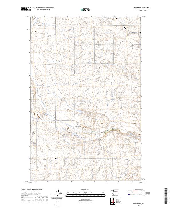
2023 Map of Wagner Lake
USGS Topo · Published 2023About this map
Wheat Ridge Cem stands as a quiet landmark in this corner of Lincoln County, where the dry plateau landscape is defined by its drainage patterns and agricultural grid. The ephemeral nature of water in this region is evident in the path of Sinking Creek and the presence of small basins like O'Brien Lake and H Lake. These features, along with Goose Creek in the northwest, provided critical water sources for the early farming families who established the township-and-range road network seen here. The map records a rural economy built on large-scale land holdings, evidenced by named thoroughfares such as Hayden Farms Rd, Smith Prather Rd, and Stambaugh Rd. This modern survey by the U.S. Geological Survey documents how historic family names persist on the land through both road designations and the small cemetery at the crossroads of Quirk Rd E and Wagner Rd N.
Find a feature on this map
30 named features on this map. Tap any name to fly to it.
Don’t see what you’re looking for? This feature index may not catch every label — zoom into the map to look around manually.
Map Details
Editions of this 2023 Wagner Lake Map
This is the sole edition of this map. No revisions or reprints were ever made.
Other maps of this area

1948 · Grand Coulee Dam
USGS Topo · 1:62,500

1948 · Wilbur
USGS Topo · 1:62,500

1950 · Wilbur
USGS Topo · 1:62,500

1950 · Grand Coulee Dam
USGS Topo · 1:62,500

1953 · Ritzville
USGS Topo · 1:250,000

1959 · Ritzville
USGS Topo · 1:250,000

1965 · Ritzville
USGS Topo · 1:250,000

1969 · Almira SE
USGS Topo · 1:24,000

1969 · Govan
USGS Topo · 1:24,000

1969 · Creston Butte
USGS Topo · 1:24,000