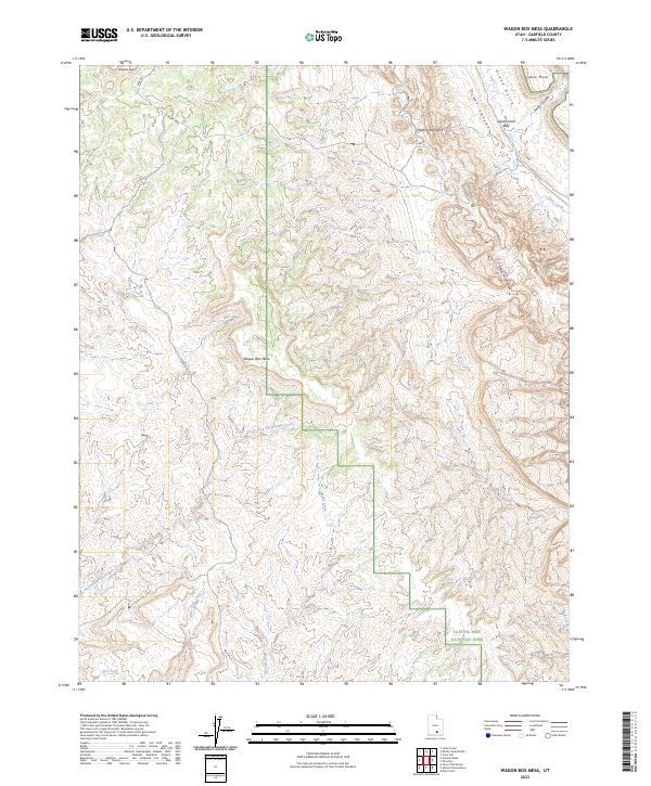
2023 Map of Wagon Box Mesa
USGS Topo · Published 2023About this map
Capitol Reef National Park boundaries anchor the southeast corner of this Garfield County landscape, where the geology of the Waterpocket Fold creates a complex network of canyons and mesas. The historic Burr Trl winds through the northwest, providing a vital corridor across the high desert terrain. Notable landmarks like Peak-a-boo Rock, Oyster Shell Reef, and the namesake Wagon Box Mesa rise above the drainage systems of Grand Gulch and Moody Creek. The intricate topography is further defined by Muley Twist Canyon and the Lower Muley Twist Trl, tracing the natural paths through the reef. This survey illustrates the modern intersection of protected wilderness areas and the established trails that have served travelers across this portion of southern Utah for generations.
Find a feature on this map
19 named features on this map. Tap any name to fly to it.
Don’t see what you’re looking for? This feature index may not catch every label — zoom into the map to look around manually.
Map Details
Editions of this 2023 Wagon Box Mesa Map
This is the sole edition of this map. No revisions or reprints were ever made.
Other maps of this area

1886 · Escalante
USGS Topo · 1:250,000

1886 · Henry Mountains
USGS Topo · 1:250,000

1892 · Henry Mountains
USGS Topo · 1:250,000

1953 · Mt Pennell
USGS Topo · 1:62,500

1953 · Circle Cliffs 1 SE
USGS Topo · 1:24,000

1953 · Circle Cliffs 4 NW
USGS Topo · 1:24,000

1953 · Circle Cliffs 1 SW
USGS Topo · 1:24,000

1953 · Mt Pennell 3 NW
USGS Topo · 1:24,000
1953 · Circle Cliffs 1 NW
USGS Topo · 1:24,000
1953 · Circle Cliffs 1 NE
USGS Topo · 1:24,000