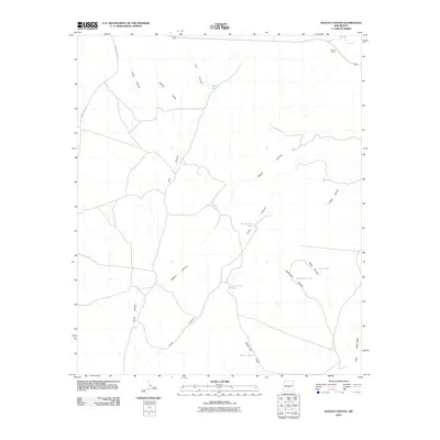
2010 Map of Wagon Canyon
USGS Topo · Published 2010About this map
Barnes Ranch stands in the northeast corner of this high-desert landscape, where ranching life depends on a scattered network of water catchment systems. Named tanks such as Pop Jackson Tank, Juan Farmer Tank, and Walker Tank are critical infrastructure points, revealing how the land was utilized for livestock in this arid Lincoln County environment. The topography is defined by a series of deep drainage systems, most notably Wagon Canyon, Lutz Canyon, and Long Canyon, which channel seasonal runoff through the territory.
Find a feature on this map
18 named features on this map. Tap any name to fly to it.
Don’t see what you’re looking for? This feature index may not catch every label — zoom into the map to look around manually.
Map Details
Editions of this 2010 Wagon Canyon Map
This is the sole edition of this map. No revisions or reprints were ever made.
Other maps of this area

1918 · Oscura Peak
USGS Topo · 1:125,000

1938 · Carrizozo
USGS Topo · 1:48,000

1943 · Carrizozo
USGS Topo · 1:62,500

1948 · Broken Back Crater
USGS Topo · 1:62,500

1948 · Chihuahua Ranch
USGS Topo · 1:62,500

1950 · Carrizozo
USGS Topo · 1:62,500

1950 · Little Black Peak
USGS Topo · 1:62,500

1954 · Tularosa
USGS Topo · 1:250,000

1955 · Roswell
USGS Topo · 1:250,000

1958 · Roswell
USGS Topo · 1:250,000