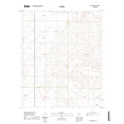
2023 Map of Wagon Canyon
USGS Topo · Published 2023About this map
The White Sands Missile Range occupies the southwestern corner of this landscape, marking a clear boundary between government-controlled territory and the surrounding terrain of the high desert. This area is defined by a series of deep drainages including Wagon Canyon, Lutz Canyon, and Taylor Canyon, which cut through the landscape north of the Socorro Co Lincoln Co line. The absence of traditional settlements is notable, with the land instead partitioned by the Public Land Survey System into townships like t7s r8e and t7s r9e. Transportation is limited to a few specific corridors, most notably WSMR P Route 11, which skirts the missile range's edge. To the southeast, the topography descends into Sixshooter Canyon and Quail Canyon, reflecting the complex watershed patterns typical of this portion of New Mexico.
Find a feature on this map
15 named features on this map. Tap any name to fly to it.
Don’t see what you’re looking for? This feature index may not catch every label — zoom into the map to look around manually.
Map Details
Editions of this 2023 Wagon Canyon Map
This is the sole edition of this map. No revisions or reprints were ever made.
Other maps of this area

1918 · Oscura Peak
USGS Topo · 1:125,000

1938 · Carrizozo
USGS Topo · 1:48,000

1943 · Carrizozo
USGS Topo · 1:62,500

1948 · Broken Back Crater
USGS Topo · 1:62,500

1948 · Chihuahua Ranch
USGS Topo · 1:62,500

1950 · Carrizozo
USGS Topo · 1:62,500

1950 · Little Black Peak
USGS Topo · 1:62,500

1954 · Tularosa
USGS Topo · 1:250,000

1955 · Roswell
USGS Topo · 1:250,000

1958 · Roswell
USGS Topo · 1:250,000