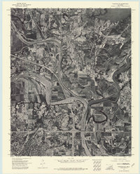
1972 Map of Wagoner SE
USGS Topo · Published 1974About this map
Arkansas River and Verdigris River converge in this 1970s orthophotomosaic, revealing the complex hydrology of the Three Forks region. This specialized photographic survey, prepared by the Geological Survey from 1972 aerial imagery, provides a clear view of the winding Neosho River and the southern reaches of Fort Gibson Lake. The landscape transition from the industrial and residential corridors of Muskogee to the established settlement of Fort Gibson is visible through the lens of early 1970s land use and river management. Researchers can trace the riverbanks and highway networks as they existed before decades of modern development altered the floodplain and suburban fringes.
Find a feature on this map
6 named features on this map. Tap any name to fly to it.
Don’t see what you’re looking for? This feature index may not catch every label — zoom into the map to look around manually.
Map Details
Editions of this 1972 Wagoner SE Map
This is the sole edition of this map. No revisions or reprints were ever made.
Other maps of this area

1901 · Muscogee
USGS Topo · 1:125,000

1905 · Muscogee
USGS Topo · 1:125,000

1946 · Fort Smith
USGS Topo · 1:250,000

1948 · Hulbert
USGS Topo · 1:62,500

1948 · Keefeton
USGS Topo · 1:62,500

1948 · Webbers Falls
USGS Topo · 1:62,500

1948 · Wagoner
USGS Topo · 1:62,500

1950 · Keefeton
USGS Topo · 1:62,500

1950 · Wagoner
USGS Topo · 1:62,500

1950 · Hulbert
USGS Topo · 1:62,500