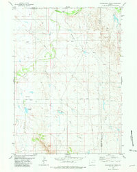
1981 Map of Wagonhound Creek
USGS Topo · Published 1981About this map
The Cheyenne River winds through the northern portion of this landscape, marking a rugged intersection of Wyoming ranch lands and water rights. Centered near Dull Center, the map reveals a remote pastoral network defined by small-scale irrigation and cattle ranching infrastructure. Private water management is evident in the presence of Dull Reservoir and Nachtman Reservoir, which capture runoff from intermittent drainages like Rattlesnake Draw and Sheep Creek.
Find a feature on this map
19 named features on this map. Tap any name to fly to it.
Don’t see what you’re looking for? This feature index may not catch every label — zoom into the map to look around manually.
Map Details
Editions of this 1981 Wagonhound Creek Map
This is the sole edition of this map. No revisions or reprints were ever made.
Other maps of this area

1955 · Newcastle
USGS Topo · 1:250,000

1958 · Newcastle
USGS Topo · 1:250,000

1971 · Fiddleback Ranch
USGS Topo · 1:24,000

1971 · Esau Spring
USGS Topo · 1:24,000

1971 · Piney Canyon SE
USGS Topo · 1:24,000

1974 · Reno Junction
USGS Topo · 1:100,000

1979 · Newcastle
USGS Topo · 1:100,000

1979 · Bill
USGS Topo · 1:100,000

1981 · Calf Draw
USGS Topo · 1:24,000

1981 · Pinnacle Rocks
USGS Topo · 1:24,000