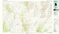
1980 Map of Wah Wah Mts. North
USGS Topo · Published 1985About this map
Mining operations and water management dominate the arid landscape of western Utah in this 1980 survey. The eastern edge of the map is defined by the expanse of Sevier Lake and the Wah Wah Valley Hardpan, while the southern reaches show a concentration of resource extraction in the San Francisco Mountains (though the mountains are primarily terrain, the specific mine sites within them are central). Here, researchers can locate the Copper-Iron Mine, Lulu Mine, and Cupric Mine near the Millard and Beaver county line.
Find a feature on this map
92 named features on this map. Tap any name to fly to it.
Don’t see what you’re looking for? This feature index may not catch every label — zoom into the map to look around manually.
Map Details
Editions of this 1980 Wah Wah Mts. North Map
2 editions found

Other maps of this area

1885 · Beaver
USGS Topo · 1:250,000

1885 · Sevier Desert
USGS Topo · 1:250,000

1908 · Fish Springs
USGS Topo · 1:250,000

1910 · Fish Springs
USGS Topo · 1:250,000

1949 · Garrison
USGS Topo · 1:62,500

1951 · Garrison
USGS Topo · 1:62,500

1953 · Richfield
USGS Topo · 1:250,000

1953 · Delta
USGS Topo · 1:250,000

1956 · Lund
USGS Topo · 1:250,000

1956 · Ely
USGS Topo · 1:250,000