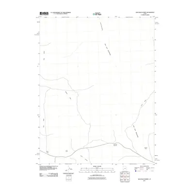
2011 Map of Wah Wah Summit
USGS Topo · Published 2011About this map
Wah Wah Summit serves as the focal point of this arid landscape, where the high-altitude pass crosses the Wah Wah Mountains. The topography is defined by significant elevation changes between the peaks and the surrounding basins, specifically Long Valley to the east and the broad expanse of Pine Valley to the west. This 2011 survey reveals a sparse network of human markers in a terrain dominated by nature, including Kelleys Place and the primitive track of Pine Valley Rd. Landmark features like Sols Knoll and Lime Point provide distinct navigational references for those traversing the desert floor. Numerous drainage patterns and erosional features such as Pierson Cove, Lawson Cove Canyon, and Corral Canyon illustrate the geological forces shaping this part of Millard County.
Find a feature on this map
11 named features on this map. Tap any name to fly to it.
Don’t see what you’re looking for? This feature index may not catch every label — zoom into the map to look around manually.
Map Details
Editions of this 2011 Wah Wah Summit Map
This is the sole edition of this map. No revisions or reprints were ever made.
Other maps of this area

1953 · Richfield
USGS Topo · 1:250,000

1958 · Richfield
USGS Topo · 1:250,000

1959 · Frisco
USGS Topo · 1:62,500

1960 · Frisco Peak
USGS Topo · 1:62,500

1960 · Wah Wah Summit
USGS Topo · 1:62,500

1971 · Sewing Machine Pass
USGS Topo · 1:24,000

1971 · Lamerdorf Peak NW
USGS Topo · 1:24,000

1980 · Wah Wah Mts. South
USGS Topo · 1:100,000

1980 · Wah Wah Mts. North
USGS Topo · 1:100,000
1989 · Wah Wah Cove
USGS Topo · 1:24,000