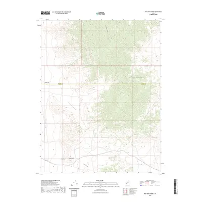
2023 Map of Wah Wah Summit
USGS Topo · Published 2023About this map
Wah Wah Summit serves as the focal point for this survey of the high desert terrain along the border of Millard and Beaver counties. The landscape is dominated by the steep rises of the Wah Wah Mountains, which divide the broad stretches of Pine Valley to the west from Long Valley to the east. The map records several distinctive geological markers and landmarks, including the curiously named Eye of Needle and Sols Knoll near the southern margin. Local topographical features such as Pierson Cove, Pierce Cove, and Lawson Cove Canyon illustrate the complex drainage patterns and erosion that have shaped this high-elevation pass. This modern topographical record provides an exact accounting of the ridgelines and canyons that have historically channeled movement through this part of the Great Basin.
Find a feature on this map
12 named features on this map. Tap any name to fly to it.
Don’t see what you’re looking for? This feature index may not catch every label — zoom into the map to look around manually.
Map Details
Editions of this 2023 Wah Wah Summit Map
This is the sole edition of this map. No revisions or reprints were ever made.
Other maps of this area

1953 · Richfield
USGS Topo · 1:250,000

1958 · Richfield
USGS Topo · 1:250,000

1959 · Frisco
USGS Topo · 1:62,500

1960 · Frisco Peak
USGS Topo · 1:62,500

1960 · Wah Wah Summit
USGS Topo · 1:62,500

1971 · Sewing Machine Pass
USGS Topo · 1:24,000

1971 · Lamerdorf Peak NW
USGS Topo · 1:24,000

1980 · Wah Wah Mts. South
USGS Topo · 1:100,000

1980 · Wah Wah Mts. North
USGS Topo · 1:100,000
1989 · Wah Wah Cove
USGS Topo · 1:24,000