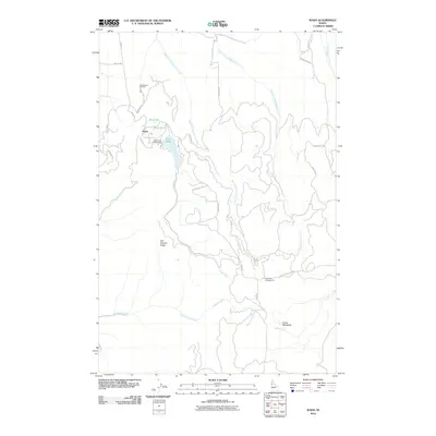
2010 Map of Waha
USGS Topo · Published 2010About this map
Lake Waha and its surrounding waters dominate this high-plateau landscape south of Lewiston, where the settlement of Waha serves as a central point for local land management. The geography is defined by deep drainage systems, including the headwaters of West Fork Sweetwater Creek and East Fork Sweetwater Creek, which carve through the high ground of Fort Simons Ridge. This 2010 survey illustrates the developed recreation and conservation infrastructure of the Nez Perce County highlands, featuring the Waha Lake Access Area and the nearby Sweetwater Hatchery.
Find a feature on this map
32 named features on this map. Tap any name to fly to it.
Don’t see what you’re looking for? This feature index may not catch every label — zoom into the map to look around manually.
Map Details
Editions of this 2010 Waha Map
This is the sole edition of this map. No revisions or reprints were ever made.
Other maps of this area

1946 · Limekiln Rapids
USGS Topo · 1:62,500

1955 · Pullman
USGS Topo · 1:250,000

1958 · Pullman
USGS Topo · 1:250,000

1958 · Sweetwater
USGS Topo · 1:24,000

1958 · Lewiston Orchards South
USGS Topo · 1:24,000

1958 · Lewiston Orchards
USGS Topo · 1:62,500

1958 · Culdesac
USGS Topo · 1:62,500

1967 · Hoover Point
USGS Topo · 1:24,000

1968 · Waha
USGS Topo · 1:24,000
1968 · Winchester West
USGS Topo · 1:24,000