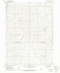
1969 Map of Wahoo SE
USGS Topo · Published 1971About this map
Rock Creek flows through the southern portion of this landscape, carving a valley that defines the border between the townships of Rock Creek and Mill. This 1960s agricultural survey documents a rural Nebraska community where social life revolved around local institutions like School No 52 and School No 102, alongside spiritual centers such as Zion Ch and Cedar Hill Ch. The mapping of the Saunders and Lancaster County line provides a precise view of the jurisdictional boundaries that shaped early property records.
Find a feature on this map
21 named features on this map. Tap any name to fly to it.
Don’t see what you’re looking for? This feature index may not catch every label — zoom into the map to look around manually.
Map Details
Editions of this 1969 Wahoo SE Map
2 editions found
Other maps of this area

1893 · Fremont
USGS Topo · 1:125,000

1896 · Fremont
USGS Topo · 1:125,000

1897 · Lincoln
USGS Topo · 1:125,000

1899 · Wahoo
USGS Topo · 1:125,000

1903 · Weeping Water
USGS Topo · 1:125,000

1929 · Weeping Water
USGS Topo · 1:125,000

1955 · Fremont
USGS Topo · 1:250,000

1955 · Lincoln
USGS Topo · 1:250,000

1957 · Fremont
USGS Topo · 1:250,000

1957 · Lincoln
USGS Topo · 1:250,000