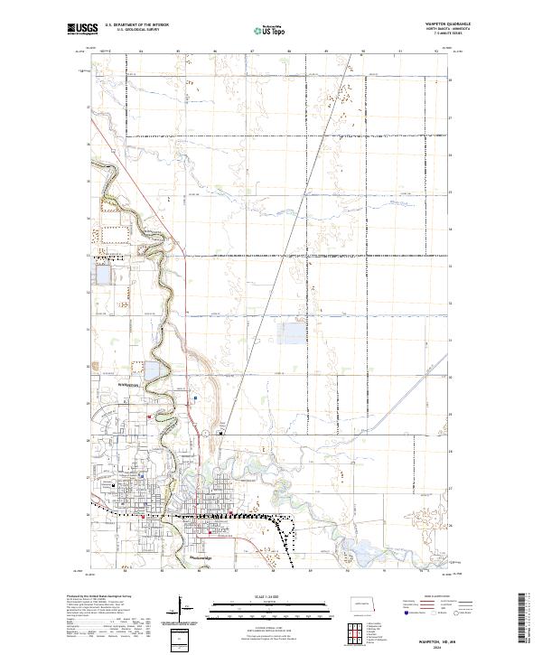
2024 Map of Wahpeton
USGS Topo · Published 2024About this map
The Red River of the North winds along the state line where Wahpeton, North Dakota, meets Breckenridge, Minnesota. This river confluence serves as a regional anchor, with the Bois de Sioux River and Otter Tail River merging to form the Red River. The map documents a dense concentration of civic and educational infrastructure, including the campus of the North Dakota State College of Science and the Richland County Courthouse. Across the state border, the Wilkin County Courthouse and Saint Marys Cemetery further define the twin-city layout.
Find a feature on this map
69 named features on this map. Tap any name to fly to it.
Don’t see what you’re looking for? This feature index may not catch every label — zoom into the map to look around manually.
Map Details
Editions of this 2024 Wahpeton Map
This is the sole edition of this map. No revisions or reprints were ever made.
Other maps of this area

1904 · Wahpeton
USGS Topo · 1:125,000

1919 · Rothsay
USGS Topo · 1:62,500

1951 · Rothsay
USGS Topo · 1:62,500

1951 · Campbell
USGS Topo · 1:62,500

1953 · Fargo
USGS Topo · 1:250,000

1956 · Fargo
USGS Topo · 1:250,000

1964 · Fairmount NW
USGS Topo · 1:24,000

1964 · Dwight
USGS Topo · 1:24,000

1964 · Wahpeton
USGS Topo · 1:24,000
1973 · Abercrombie
USGS Topo · 1:24,000