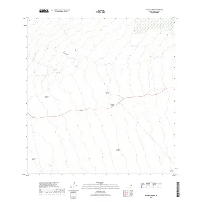
2017 Map of Waikoloa Ponds
USGS Topo · Published 2017About this map
Volcanic history dominates this portion of the Island of Hawai'i, where the high slopes are defined by a sequence of historical eruptions. Multiple distinct paths, including the Lava Flow of 1852, Lava Flow of 1855, and the Lava Flow of 1881, illustrate the ongoing transformation of the landscape over the last two centuries. These geological events are layered alongside the Lava Flow of 1935 and Lava Flow of 1942, showing how modern flows have repeatedly shaped the watershed.
Find a feature on this map
10 named features on this map. Tap any name to fly to it.
Don’t see what you’re looking for? This feature index may not catch every label — zoom into the map to look around manually.
Map Details
Editions of this 2017 Waikoloa Ponds Map
This is the sole edition of this map. No revisions or reprints were ever made.
Other maps of this area

1915 · Honomu
USGS Topo · 1:62,500

1917 · Hilo
USGS Topo · 1:62,500

1930 · Humuula
USGS Topo · 1:62,500

1932 · Hilo
USGS Topo · 1:62,500

1954 · Hawaii North
USGS Topo · 1:250,000

1956 · Puu Oo
USGS Topo · 1:24,000

1956 · Pua Akala
USGS Topo · 1:24,000

1956 · Upper Piihonua
USGS Topo · 1:24,000
1956 · Puu Ulaula
USGS Topo · 1:24,000
1956 · Kulani
USGS Topo · 1:24,000