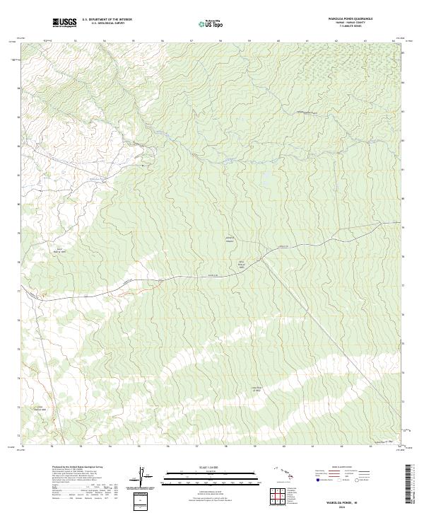
2024 Map of Waikoloa Ponds
USGS Topo · Published 2024About this map
Geological history is etched across the landscape of the Island of Hawai‘i, where successive volcanic events have shaped the high-elevation terrain between the island's massive peaks. This modern survey meticulously identifies the chronological layers of activity, from the Lava Flow of 1852 and Lava Flow of 1855 to the more recent Lava Flow of 1942. The transit corridor of Saddle Rd cuts through these basaltic fields, following a path flanked by historic routes like the Kaumana Trl. In the upper reaches of the quadrangle, the Wailuku River and the isolated Waikoloa Ponds provide rare hydrologic features amidst the porous volcanic rock. The terrain is deeply incised by drainages such as Waipāhoehoe Gulch and Waiama Gulch, which illustrate the long-term erosion patterns of the island's windward-facing slopes.
Find a feature on this map
13 named features on this map. Tap any name to fly to it.
Don’t see what you’re looking for? This feature index may not catch every label — zoom into the map to look around manually.
Map Details
Editions of this 2024 Waikoloa Ponds Map
This is the sole edition of this map. No revisions or reprints were ever made.
Other maps of this area

1915 · Honomu
USGS Topo · 1:62,500

1917 · Hilo
USGS Topo · 1:62,500

1930 · Humuula
USGS Topo · 1:62,500

1932 · Hilo
USGS Topo · 1:62,500

1954 · Hawaii North
USGS Topo · 1:250,000

1956 · Puu Oo
USGS Topo · 1:24,000

1956 · Pua Akala
USGS Topo · 1:24,000

1956 · Upper Piihonua
USGS Topo · 1:24,000
1956 · Puu Ulaula
USGS Topo · 1:24,000
1956 · Kulani
USGS Topo · 1:24,000