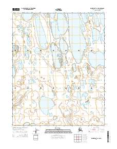
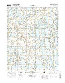
2014 Map of Wainwright A-1 NE
USGS Topo · Published 2014About this map
Takrak Lake and the meandering path of Oyagaruk Cr define this specialized look at the North Slope during the early 2010s. This specific region of the Arctic coastal plain is characterized by a high density of thaw lakes and thermokarst features, typical of the permafrost-dominated environment within the t10n r29w and t9n r29w land divisions. The surface is almost entirely water and saturated tundra, where subtle elevation changes dictate the flow of seasonal drainages. This survey, which incorporates data from the Alaska Dept. of Transportation and the BLM, serves as a high-resolution benchmark for the shifting hydrology and shoreline configurations of this northern landscape before further environmental changes occur in the 21st century.
Find a feature on this map
6 named features on this map. Tap any name to fly to it.
Don’t see what you’re looking for? This feature index may not catch every label — zoom into the map to look around manually.
Map Details
Editions of this 2014 Wainwright A-1 NE Map
This is the sole edition of this map. No revisions or reprints were ever made.
Other maps of this area

1951 · Meade River
USGS Topo · 1:250,000

1951 · Wainwright
USGS Topo · 1:250,000

1955 · Wainwright
USGS Topo · 1:250,000

1955 · Wainwright B-1
USGS Topo · 1:63,360

1955 · Meade River
USGS Topo · 1:250,000
1955 · Meade River A-5
USGS Topo · 1:63,360
1955 · Meade River B-5
USGS Topo · 1:63,360
1955 · Wainwright A-1
USGS Topo · 1:63,360

1964 · Wainwright
USGS Topo · 1:250,000
2014 · Wainwright B-1 SE
USGS Topo · 1:25,000