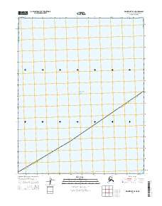
2014 Map of Wainwright B-4 NE
USGS Topo · Published 2014About this map
The Chukchi Sea dominates the northern half of this coastal area within the North Slope Borough. The maritime landscape is defined by the open waters of the sea and the coastal transition near Pingorarok Pass in the southeast. Inland, the map reveals the systematic organization of the Public Land Survey System, specifically identifying townships t12n r36w and t12n r35w. This 2014 survey documents a remote stretch of the Alaskan coastline where the intersection of arctic waters and the borough boundary provides a specialized look at the region's geography prior to recent environmental shifts.
Find a feature on this map
5 named features on this map. Tap any name to fly to it.
Don’t see what you’re looking for? This feature index may not catch every label — zoom into the map to look around manually.
Map Details
Editions of this 2014 Wainwright B-4 NE Map
This is the sole edition of this map. No revisions or reprints were ever made.
Other maps of this area

1951 · Wainwright
USGS Topo · 1:250,000

1955 · Wainwright
USGS Topo · 1:250,000
1955 · Wainwright B-3
USGS Topo · 1:63,360
1955 · Wainwright B-4
USGS Topo · 1:63,360
1955 · Wainwright C-3
USGS Topo · 1:63,360

1964 · Wainwright
USGS Topo · 1:250,000
2014 · Wainwright B-3 NW
USGS Topo · 1:25,000
2014 · Wainwright B-4 SE
USGS Topo · 1:25,000
2014 · Wainwright B-3 SW
USGS Topo · 1:25,000
2014 · Wainwright B-4 SW
USGS Topo · 1:25,000