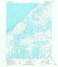
1955 Map of Wainwright B-3
USGS Topo · Published 1971About this map
Chukchi Sea waves meet the low-lying tundra of the North Slope in this mid-century survey, defined by the barrier beach of Kasegaluk Lagoon. The landscape is dominated by a complex network of thaw lakes and ponds, typical of the Arctic coastal plain. Along the shoreline, former habitation sites like Kilimantavi and Mitliktavik are marked as abandoned, indicating a shift in settlement patterns away from these coastal outposts during the early 20th century. A Winter Trail skirts the coast, providing a critical seasonal connection across the permafrost terrain. In the interior, the Alataktok River and Apikuurruak Creek drain through the saturated plains toward the larger Kuk River system, while Pingorarok Hill provides a rare point of elevation in an otherwise flat expanse of wetlands.
Find a feature on this map
9 named features on this map. Tap any name to fly to it.
Don’t see what you’re looking for? This feature index may not catch every label — zoom into the map to look around manually.
Map Details
Editions of this 1955 Wainwright B-3 Map
This is the sole edition of this map. No revisions or reprints were ever made.
Other maps of this area

1951 · Wainwright
USGS Topo · 1:250,000

1955 · Wainwright
USGS Topo · 1:250,000

1955 · Wainwright A-2
USGS Topo · 1:63,360
1955 · Wainwright A-3
USGS Topo · 1:63,360
1955 · Wainwright C-2
USGS Topo · 1:63,360
1955 · Wainwright A-4
USGS Topo · 1:63,360
1955 · Wainwright B-2
USGS Topo · 1:63,360
1955 · Wainwright B-4
USGS Topo · 1:63,360
1955 · Wainwright C-3
USGS Topo · 1:63,360

1964 · Wainwright
USGS Topo · 1:250,000