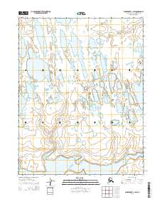
2014 Map of Wainwright C-1 SW
USGS Topo · Published 2014About this map
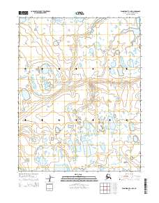
Kungok River dominates the southern landscape of this Arctic expanse, carving a wide path through the marshy lowlands of the North Slope. The terrain is defined by a dense network of thaw lakes and ponds, a characteristic feature of the permafrost environment where drainage is dictated by the subtle shifts in elevation. In the northwest corner, the Sinaruruk River meanders toward the coast, while Amagoalik Cr drains the southwestern reaches. The absence of permanent structures or roads reflects the seasonal nature of the landscape, where travel and land use are tied to the water cycles of these major river systems. This map provides a detailed view of the natural hydrology and township boundaries including t13n r30w and t15n r29w during the early 21st century.
Find a feature on this map
9 named features on this map. Tap any name to fly to it.
Don’t see what you’re looking for? This feature index may not catch every label — zoom into the map to look around manually.
Map Details
Editions of this 2014 Wainwright C-1 SW Map
This is the sole edition of this map. No revisions or reprints were ever made.
Other maps of this area

1951 · Wainwright
USGS Topo · 1:250,000

1955 · Wainwright
USGS Topo · 1:250,000

1955 · Wainwright B-1
USGS Topo · 1:63,360

1955 · Wainwright C-1
USGS Topo · 1:63,360
1955 · Wainwright C-2
USGS Topo · 1:63,360
1955 · Wainwright B-2
USGS Topo · 1:63,360

1964 · Wainwright
USGS Topo · 1:250,000
2014 · Wainwright B-1 NW
USGS Topo · 1:25,000
2014 · Wainwright C-1 NW
USGS Topo · 1:25,000
2014 · Wainwright C-1 SE
USGS Topo · 1:25,000