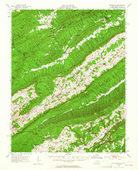
1951 Map of Waiteville
USGS Topo · Published 1965About this map
Johns Creek Mountain and Sinking Creek Mountain dominate this landscape, their long ridges framing narrow valleys where rural life centered on small settlements and mountain agriculture. In the mid-century, communities like Waiteville, Simmonsville, and Maggie followed the alignment of the water gaps and creek beds, while the Norfolk and Western Ry skirted the southern reaches near Newport. The map reveals a high density of rural institutions, from Slussers Chapel and Mt Carmel Ch to the Maywood Sch and Mt Tabor Sch, marking the social nodes of these isolated valleys. Local industry is represented by Valley Mill and Bennetts Mill, indicating the continued importance of water-powered or small-scale processing. Steep terrain features like Kelly Knob and Lone Pine Peak separate the drainage of Potts Creek from the Roanoke River headwaters, within the bounds of the Jefferson National Forest.
Find a feature on this map
89 named features on this map. Tap any name to fly to it.
Don’t see what you’re looking for? This feature index may not catch every label — zoom into the map to look around manually.
Map Details
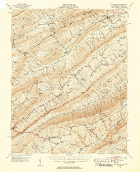
Editions of this 1951 Waiteville Map
3 editions found

Other maps of this area

1887 · Hinton
USGS Topo · 1:125,000

1887 · Lewisburg
USGS Topo · 1:125,000

1890 · Dublin
USGS Topo · 1:125,000

1890 · Christiansburg
USGS Topo · 1:125,000

1891 · Lewisburg
USGS Topo · 1:125,000

1891 · Dublin
USGS Topo · 1:125,000

1892 · Hinton
USGS Topo · 1:125,000

1921 · Alderson
USGS Topo · 1:48,000

1921 · Ronceverte
USGS Topo · 1:48,000

1923 · Ronceverte
USGS Topo · 1:62,500