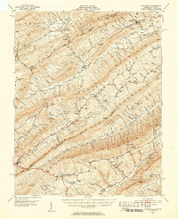
1951 Map of Waiteville
USGS Topo · Published 1953About this map
Peters Mtn and Potts Mountain dominate the northern landscape of this Virginia-West Virginia borderland, where the mountain ranges of the Jefferson National Forest define the orientation of every community and creek. The settlement pattern follows the narrow valley floors, anchored by places like Waiteville and Simmonsville. Transportation and industry in the early 1950s remained closely tied to the terrain, evidenced by the Ray Siding rail point and the presence of local processing sites such as Valley Mill and Bennetts Mill.
Find a feature on this map
135 named features on this map. Tap any name to fly to it.
Don’t see what you’re looking for? This feature index may not catch every label — zoom into the map to look around manually.
Map Details
Editions of this 1951 Waiteville Map
3 editions found

Other maps of this area

1887 · Hinton
USGS Topo · 1:125,000

1887 · Lewisburg
USGS Topo · 1:125,000

1890 · Dublin
USGS Topo · 1:125,000

1890 · Christiansburg
USGS Topo · 1:125,000

1891 · Lewisburg
USGS Topo · 1:125,000

1891 · Dublin
USGS Topo · 1:125,000

1892 · Hinton
USGS Topo · 1:125,000

1921 · Alderson
USGS Topo · 1:48,000

1921 · Ronceverte
USGS Topo · 1:48,000

1923 · Ronceverte
USGS Topo · 1:62,500