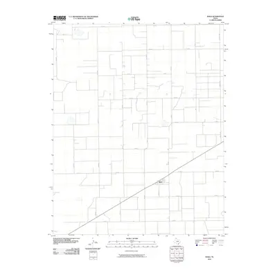
2010 Map of Waka
USGS Topo · Published 2010About this map
Waka serves as the central point of activity in this northern Panhandle landscape, where the town's small grid is anchored by Greever St and oriented along the diagonal path of the regional highway. The surrounding High Plains terrain is meticulously partitioned into a vast agricultural grid, defined by a network of rural routes including Co Rd J to the north and Co Rd R at the southern boundary. This 2010 survey illustrates the extreme regularity of Ochiltree County's land division, where long straightaways like Farm Rd 1267 and Co Rd 30 facilitate transport across an open, productive landscape. Aside from the concentrated settlement at Waka, the map reveals a sparse distribution of structures, highlighting the large-scale farming operations that characterize the Texas Panhandle's modern era.
Find a feature on this map
18 named features on this map. Tap any name to fly to it.
Don’t see what you’re looking for? This feature index may not catch every label — zoom into the map to look around manually.
Map Details
Editions of this 2010 Waka Map
This is the sole edition of this map. No revisions or reprints were ever made.
Other maps of this area

1954 · Perryton
USGS Topo · 1:250,000

1958 · Perryton
USGS Topo · 1:250,000

1962 · Hansford Camp
USGS Topo · 1:24,000

1962 · Waka SW
USGS Topo · 1:24,000

1962 · Spearman
USGS Topo · 1:24,000

1973 · Farnsworth
USGS Topo · 1:24,000

1973 · Horseshoe Hill
USGS Topo · 1:24,000

1973 · Waka
USGS Topo · 1:24,000

1973 · Spearman NE
USGS Topo · 1:24,000

1973 · Sourdough Creek NW
USGS Topo · 1:24,000