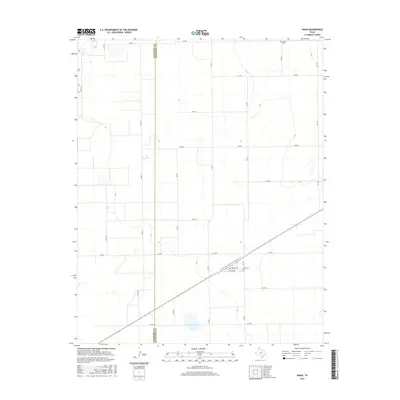
2016 Map of Waka
USGS Topo · Published 2016About this map
The Hansford Co Ochiltree Co boundary bisects this High Plains landscape, where the town of Waka sits at the intersection of rural thoroughfares and rail-aligned streets. This 2016 survey captures a strictly organized grid of county roads, including Co Rd P and Co Rd 3, which serve the agricultural interests of the Texas Panhandle. Local heritage is anchored by sites such as Waka Cem near the town center and Bethel Cem in the northeastern quadrant. The town's small footprint is defined by named ways like Rogers Ave and Butler Ave, while the broader region is connected by FM 1267. The geography is characterized by the expansive, open terrain typical of the Llano Estacado, where the rectilinear road system dictates the movement of people and commerce between these two neighboring counties.
Find a feature on this map
22 named features on this map. Tap any name to fly to it.
Don’t see what you’re looking for? This feature index may not catch every label — zoom into the map to look around manually.
Map Details
Editions of this 2016 Waka Map
This is the sole edition of this map. No revisions or reprints were ever made.
Other maps of this area

1954 · Perryton
USGS Topo · 1:250,000

1958 · Perryton
USGS Topo · 1:250,000

1962 · Hansford Camp
USGS Topo · 1:24,000

1962 · Waka SW
USGS Topo · 1:24,000

1962 · Spearman
USGS Topo · 1:24,000

1973 · Farnsworth
USGS Topo · 1:24,000

1973 · Horseshoe Hill
USGS Topo · 1:24,000

1973 · Waka
USGS Topo · 1:24,000

1973 · Spearman NE
USGS Topo · 1:24,000

1973 · Sourdough Creek NW
USGS Topo · 1:24,000