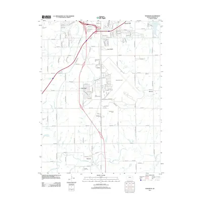
2012 Map of Wakarusa
USGS Topo · Published 2012About this map
The Wakarusa River meanders across the southern portion of this landscape, anchoring a region defined by the southward expansion of the state capital's metropolitan influence. Substantial infrastructure dominates the central corridor, notably the Forbes Field Airport and the complex South Topeka Interchange. This 2012 survey illustrates a transition from the dense residential and commercial clusters of Pauline and Terra Heights to the smaller, more traditional communities of Berryton and Wakarusa. For genealogists, the map is particularly valuable for its precise location of several burial grounds, including the Foster Cem near the northern boundary and the Yocum Cem further south. Large-scale developments like Heartland Park Topeka and Central Crossing Commerce Park represent the modern industrial and recreational footprint of Shawnee County during this era.
Find a feature on this map
129 named features on this map. Tap any name to fly to it.
Don’t see what you’re looking for? This feature index may not catch every label — zoom into the map to look around manually.
Map Details
Editions of this 2012 Wakarusa Map
This is the sole edition of this map. No revisions or reprints were ever made.
Other maps of this area

1889 · Burlingame
USGS Topo · 1:125,000

1889 · Topeka
USGS Topo · 1:125,000

1894 · Burlingame
USGS Topo · 1:125,000

1894 · Topeka
USGS Topo · 1:125,000

1947 · Lawrence
USGS Topo · 1:250,000

1950 · Kansas City
USGS Topo · 1:250,000

1950 · Lawrence
USGS Topo · 1:250,000

1950 · Topeka
USGS Topo · 1:24,000

1950 · Grantville
USGS Topo · 1:24,000

1951 · Grantville
USGS Topo · 1:24,000