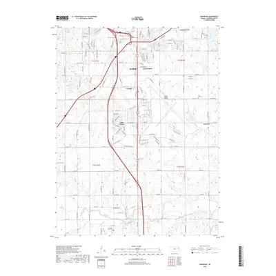
2018 Map of Wakarusa
USGS Topo · Published 2018About this map
The Wakarusa River flows across the southern reaches of this landscape, anchoring a region where the outskirts of southern Topeka meet the rural expanses of Shawnee County. The transition from urban center to prairie township is marked by the presence of Topeka Regional Airport and the surrounding industrial and residential corridors of Pauline and Cullen Village. To the east, the settlement of Berryton sits near the headwaters of Linn Creek, while the eponymous village of Wakarusa remains a focal point along the riverbanks in the southwest. Local history is etched into the terrain through several family and community burial grounds, including Lynn Creek Cem, Foster Cem, and Shawnee Center Cem. The geography is further defined by numerous small waterways such as South Branch Shunganunga Creek and Colly Creek, illustrating the complex drainage patterns that shaped the early development and road networks of these Kansas townships.
Find a feature on this map
72 named features on this map. Tap any name to fly to it.
Don’t see what you’re looking for? This feature index may not catch every label — zoom into the map to look around manually.
Map Details
Editions of this 2018 Wakarusa Map
This is the sole edition of this map. No revisions or reprints were ever made.
Other maps of this area

1889 · Burlingame
USGS Topo · 1:125,000

1889 · Topeka
USGS Topo · 1:125,000

1894 · Burlingame
USGS Topo · 1:125,000

1894 · Topeka
USGS Topo · 1:125,000

1947 · Lawrence
USGS Topo · 1:250,000

1950 · Kansas City
USGS Topo · 1:250,000

1950 · Lawrence
USGS Topo · 1:250,000

1950 · Topeka
USGS Topo · 1:24,000

1950 · Grantville
USGS Topo · 1:24,000

1951 · Grantville
USGS Topo · 1:24,000