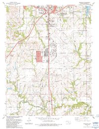
1983 Map of Wakarusa
USGS Topo · Published 1984About this map
Forbes Field and its extensive control infrastructure dominate the landscape south of Topeka in this early 1980s revision. The area exhibits a dense network of transportation and utilities, from the Kansas Toll Road Turnpike and the South Topeka Interchange to major corridors for the Atchison Topeka and Santa Fe and Missouri Pacific railroads. While the northern section shows suburban growth like Terra Heights and various trailer parks, the southern reaches maintain a rural character centered on the Wakarusa River. Local history is preserved in several family and community burial grounds, including Foster Cem, Simmerwell Cem, and Yocum Cem. The map also captures educational and social hubs such as Pauline Central Sch and the Drive-in Theater, reflecting the mid-century development patterns that expanded out from the state capital into Mission and Williamsport townships.
Find a feature on this map
45 named features on this map. Tap any name to fly to it.
Don’t see what you’re looking for? This feature index may not catch every label — zoom into the map to look around manually.
Map Details
Editions of this 1983 Wakarusa Map
This is the sole edition of this map. No revisions or reprints were ever made.
Other maps of this area

1889 · Burlingame
USGS Topo · 1:125,000

1889 · Topeka
USGS Topo · 1:125,000

1894 · Burlingame
USGS Topo · 1:125,000

1894 · Topeka
USGS Topo · 1:125,000

1947 · Lawrence
USGS Topo · 1:250,000

1950 · Kansas City
USGS Topo · 1:250,000

1950 · Lawrence
USGS Topo · 1:250,000

1950 · Topeka
USGS Topo · 1:24,000

1950 · Grantville
USGS Topo · 1:24,000

1951 · Grantville
USGS Topo · 1:24,000