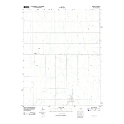
2010 Map of Wakita
USGS Topo · Published 2010About this map
Wakita anchors the southern portion of this Grant County landscape, where the town's residential street grid meets the expansive agricultural section lines of northern Oklahoma. Near the Kansas border, the settlement of Gibbon remains a notable point of reference along the western edge, accompanied by the Gibbon Cemetery. This territory is defined by the winding paths of Crooked Creek and Duel Creek, which break the geometric precision of the rural road network. The map illustrates a classic Great Plains settlement pattern, where small hubs were established at regular intervals to serve the surrounding farmstead economy. Local researchers can trace the connectivity of the region through the extensive grid of section roads, including Se 106 RD and n2830 RD, which facilitate movement between these quiet agricultural communities.
Find a feature on this map
22 named features on this map. Tap any name to fly to it.
Don’t see what you’re looking for? This feature index may not catch every label — zoom into the map to look around manually.
Map Details
Editions of this 2010 Wakita Map
This is the sole edition of this map. No revisions or reprints were ever made.
Other maps of this area

1889 · Anthony
USGS Topo · 1:125,000

1889 · Caldwell
USGS Topo · 1:125,000

1891 · Anthony
USGS Topo · 1:125,000

1893 · Caldwell
USGS Topo · 1:125,000

1897 · Caldwell
USGS Topo · 1:125,000

1955 · Wichita
USGS Topo · 1:250,000

1955 · Enid
USGS Topo · 1:250,000

1955 · Woodward
USGS Topo · 1:250,000

1955 · Pratt
USGS Topo · 1:250,000

1958 · Enid
USGS Topo · 1:250,000