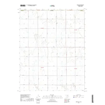
2018 Map of Wakita NE
USGS Topo · Published 2018About this map
The Stateline Rd corridor defines this prairie landscape on the border of Kansas and Oklahoma in Sumner and Grant counties. This 2018 survey documents a remote section of the Great Plains characterized by a strictly rectilinear township and range grid, where section-line roads like Renfrow Rd, Mcclain Rd, and Noble Rd carve the agricultural terrain into uniform blocks. The natural drainage of Pond Cr and Osage Cr provides the only significant break in the geometric land pattern, with the small Springdale Cem standing as a quiet landmark for local family historians. These small watercourses meander through the southern reaches of Sumner County and northern Grant County, crossing under throughways such as Kiowa Rd and Wakita Rd in a region where geography is largely dictated by the survey lines of the 19th century.
Find a feature on this map
28 named features on this map. Tap any name to fly to it.
Don’t see what you’re looking for? This feature index may not catch every label — zoom into the map to look around manually.
Map Details
Editions of this 2018 Wakita NE Map
This is the sole edition of this map. No revisions or reprints were ever made.
Other maps of this area

1889 · Caldwell
USGS Topo · 1:125,000

1893 · Caldwell
USGS Topo · 1:125,000

1897 · Caldwell
USGS Topo · 1:125,000

1955 · Wichita
USGS Topo · 1:250,000

1955 · Enid
USGS Topo · 1:250,000

1958 · Enid
USGS Topo · 1:250,000

1958 · Wichita
USGS Topo · 1:250,000

1968 · Wakita
USGS Topo · 1:24,000

1968 · Wakita SE
USGS Topo · 1:24,000

1968 · Renfrow
USGS Topo · 1:24,000