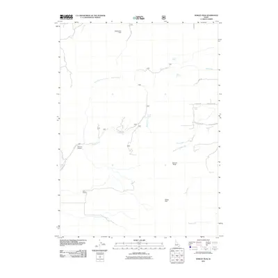
2011 Map of Wakley Peak
USGS Topo · Published 2011About this map
Wakley Peak and Rattlesnake Peak anchor this high-elevation landscape within the Bannock Range, where a network of remote canyons and vital water sources defined the early livestock and transit routes of Idaho. The terrain is deeply incised by drainages such as Farmers Canyon and Cliff Canyon, which feed into major watercourses like Wright Creek and Reese Creek. For local historians, the numerous named springs, including Wursten Spring, Shrives Spring, and Butch Spring, indicate the historical importance of reliable water in this arid upland environment. The road network, featuring names like W Chicken Flats Rd and Perlite Rd, reflects the area's ongoing use for grazing and resource access. This map documents a sparsely populated but ecologically significant portion of the intermountain west, where life and movement are dictated by the presence of water and the orientation of the ridges.
Find a feature on this map
27 named features on this map. Tap any name to fly to it.
Don’t see what you’re looking for? This feature index may not catch every label — zoom into the map to look around manually.
Map Details
Editions of this 2011 Wakley Peak Map
This is the sole edition of this map. No revisions or reprints were ever made.
Other maps of this area

1954 · Pocatello
USGS Topo · 1:250,000

1958 · Pocatello
USGS Topo · 1:250,000

1963 · Daniels
USGS Topo · 1:24,000

1968 · Daniels
USGS Topo · 1:24,000

1968 · Malad Summit
USGS Topo · 1:24,000

1968 · Dairy Creek
USGS Topo · 1:24,000

1968 · Downey West
USGS Topo · 1:24,000

1968 · Wakley Peak
USGS Topo · 1:24,000
1968 · Elkhorn Peak
USGS Topo · 1:24,000

1968 · Hawkins
USGS Topo · 1:24,000