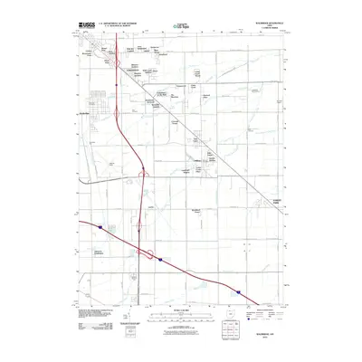
2010 Map of Walbridge
USGS Topo · Published 2010About this map
Northwood and the adjacent industrial and residential corridors of Walbridge and Millbury define this Wood County landscape during the early 21st century. The map highlights a complex logistics and transit network, dominated by the massive Walbridge Yard and the regional aviation hub at Metcalf Field. Suburban expansion is evident through numerous named additions and subdivisions such as Brighton Gardens, Park Du Langlade, and Aztec Subdivision. This residential growth is closely tied to the natural drainage of the region, with Dry Creek, Cedar Creek, and Crane Creek threading between agricultural plots and burgeoning neighborhoods. Long-standing local landmarks like Lake Cemetery and the Chippewa Golf Course provide continuity amidst the evolving infrastructure of northwestern Ohio, while the rural-urban interface is captured through designated properties like Cresceus Farms and Hille Farms.
Find a feature on this map
91 named features on this map. Tap any name to fly to it.
Don’t see what you’re looking for? This feature index may not catch every label — zoom into the map to look around manually.
Map Details
Editions of this 2010 Walbridge Map
This is the sole edition of this map. No revisions or reprints were ever made.
Other maps of this area

1900 · Maumee Bay
USGS Topo · 1:62,500

1900 · Toledo
USGS Topo · 1:62,500

1901 · Bowling Green
USGS Topo · 1:62,500

1901 · Elmore
USGS Topo · 1:62,500

1903 · Bowling Green
USGS Topo · 1:62,500

1903 · Elmore
USGS Topo · 1:62,500

1934 · Reno Beach
USGS Topo · 1:24,000

1934 · Point Place
USGS Topo · 1:24,000

1934 · Rossford
USGS Topo · 1:24,000

1935 · Walbridge
USGS Topo · 1:24,000