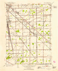
1952 Map of Walbridge
USGS Topo · Published 1953About this map
Walbridge and the surrounding townships of Lake, Allen, and Clay are depicted in this mid-century portrait of Wood and Ottawa counties. The landscape is defined by the intersection of industrial logistics and agricultural heritage, where the massive Walbridge Yard and the Pennsylvania Railroad meet a network of small residential clusters like Brighton Gardens, Cresceus Farms, and Rochester Place. This era shows the pre-jet age footprint of the Toledo Airport and cultural landmarks such as a local Drive-in Theater.
Find a feature on this map
68 named features on this map. Tap any name to fly to it.
Don’t see what you’re looking for? This feature index may not catch every label — zoom into the map to look around manually.
Map Details
Editions of this 1952 Walbridge Map
This is the sole edition of this map. No revisions or reprints were ever made.
Other maps of this area

1900 · Maumee Bay
USGS Topo · 1:62,500

1900 · Toledo
USGS Topo · 1:62,500

1901 · Bowling Green
USGS Topo · 1:62,500

1901 · Elmore
USGS Topo · 1:62,500

1903 · Bowling Green
USGS Topo · 1:62,500

1903 · Elmore
USGS Topo · 1:62,500

1934 · Reno Beach
USGS Topo · 1:24,000

1934 · Point Place
USGS Topo · 1:24,000

1934 · Rossford
USGS Topo · 1:24,000

1935 · Walbridge
USGS Topo · 1:24,000