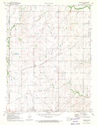
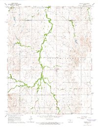
1971 Map of Waldeck
USGS Topo · Published 1972About this map
Waldeck and Lehigh serve as the primary rail-oriented hubs in this rural landscape at the start of the 1970s. The region is defined by a dense network of watercourses, including the North Cottonwood River, South Cottonwood River, and French Creek, which carved the drainage patterns for the surrounding farmland. Two major rail systems, the Chicago Rock Island and Pacific and the Atchison Topeka and Santa Fe, cut across the terrain, reflecting the area's importance as a mid-continent transport corridor. Local history is anchored by the Mennonite Cem and Lehigh Cem, while several Oil Wells and an active Pipeline indicate the presence of energy extraction alongside traditional agriculture. The boundary between McPherson and Marion counties runs vertically along the western edge, marking a clear division in this central Kansas prairie.
Find a feature on this map
22 named features on this map. Tap any name to fly to it.
Don’t see what you’re looking for? This feature index may not catch every label — zoom into the map to look around manually.
Map Details
Editions of this 1971 Waldeck Map
2 editions found
Other maps of this area

1889 · Newton
USGS Topo · 1:125,000

1889 · Abilene
USGS Topo · 1:125,000

1894 · Newton
USGS Topo · 1:125,000

1894 · Abilene
USGS Topo · 1:125,000

1955 · Hutchinson
USGS Topo · 1:250,000

1959 · Hutchinson
USGS Topo · 1:250,000
1964 · Gypsum SE
USGS Topo · 1:24,000
1964 · Tampa
USGS Topo · 1:24,000
1964 · Roxbury
USGS Topo · 1:24,000

1971 · Durham
USGS Topo · 1:24,000