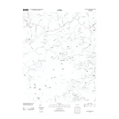
2013 Map of Walden Creek
USGS Topo · Published 2013About this map
Waldens Creek and its namesake waterway flow through a complex system of ridges and knobs in Sevier County, defining a landscape of small, dispersed settlements during the early 21st century. The map reveals the intricate network of family-named roads and mountain passages, such as Millstone Gap and Horse Gap, which have historically connected communities like Cusick, Dupont Springs, and Hornet. The topography is dominated by numerous high points, including Sugarloaf Mountain, Big Pine Mountain, and the curiously named The Wolfhook. Small tributaries like Patty Br and Murphy Br drain the hollows between prominent features like Sinkhole Mountain and Blue Rock Mountain. This 2013 survey illustrates the enduring rural character of the region, where legacy place names like Headrick Top and Pleasant Hill persist alongside newer residential infrastructure, providing a clear record of the area's development patterns and geographical landmarks.
Find a feature on this map
210 named features on this map. Tap any name to fly to it.
Don’t see what you’re looking for? This feature index may not catch every label — zoom into the map to look around manually.
Map Details
Editions of this 2013 Walden Creek Map
This is the sole edition of this map. No revisions or reprints were ever made.
Other maps of this area

1886 · Knoxville
USGS Topo · 1:125,000

1892 · Knoxville
USGS Topo · 1:125,000

1894 · Knoxville
USGS Topo · 1:125,000

1895 · Knoxville
USGS Topo · 1:125,000

1901 · Knoxville
USGS Topo · 1:125,000

1935 · Knoxville
USGS Topo · 1:48,000

1935 · Walden Creek
USGS Topo · 1:24,000

1935 · Wildwood
USGS Topo · 1:24,000

1935 · Sevierville
USGS Topo · 1:48,000
1935 · Boyds Creek
USGS Topo · 1:24,000