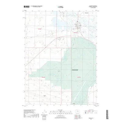
2019 Map of Walden
USGS Topo · Published 2019About this map
Walden serves as the focal point of this high-altitude basin, where the Jackson County Courthouse and Walden-Jackson County Airport anchor the local infrastructure. The surrounding landscape is defined by an intricate network of irrigation ditches such as Queen Ditch, Ruction Ditch, and Boyce Brothers Ditch, which redirect water from the Michigan River and Illinois River to support the high country's ranching economy. This managed water system is vital for the region, feeding various storage facilities like Walden Reservoir and the Case Reservoir Number 1 through Case Reservoir Number 3 series. Much of the southern and eastern terrain is preserved within the Arapaho National Wildlife Refuge, where the braided paths of Potter Creek and Antelope Cr cross the Case Flats. The map illustrates a delicate balance between natural wetlands and the engineered waterways required for human settlement in the North Park area.
Find a feature on this map
67 named features on this map. Tap any name to fly to it.
Don’t see what you’re looking for? This feature index may not catch every label — zoom into the map to look around manually.
Map Details
Editions of this 2019 Walden Map
This is the sole edition of this map. No revisions or reprints were ever made.
Other maps of this area

1954 · Craig
USGS Topo · 1:250,000

1955 · Lake John
USGS Topo · 1:24,000

1955 · Eagle Hill
USGS Topo · 1:24,000

1955 · Delaney Butte
USGS Topo · 1:24,000

1955 · Coalmont
USGS Topo · 1:24,000

1955 · Owl Ridge
USGS Topo · 1:24,000

1955 · Gould NW
USGS Topo · 1:24,000

1955 · Walden
USGS Topo · 1:24,000

1955 · Mac Farlane Reservoir
USGS Topo · 1:24,000

1955 · Kings Canyon
USGS Topo · 1:62,500